MarkerMaker
A browser-based roadway mapping tool for plotting driving routes, generating mileage-based segment markers, capturing cross-street information, and exporting structured route data to Excel.
From Route Geometry to Segments
MarkerMaker retrieves driving-route geometry and processes it locally to calculate positions along the roadway. Mileage-based markers can then be generated at configurable intervals without requiring an additional routing request for every point.
Cross-Street Workflow
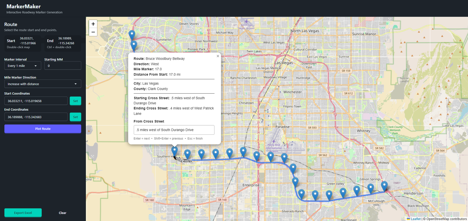
Generated markers can be reviewed directly on the map and supplemented with cross-street information. Keyboard navigation makes it possible to move quickly between markers while building a complete roadway segment dataset.
Interactive Route Building
The interface combines route selection, mileage controls, segment generation, map-based editing, and Excel export into a single workflow.
Tenth-Mile Calculations
Once route geometry is returned, tenth-mile positions are calculated locally along the route. This keeps repeated geographic calculations inside the application rather than making separate external API requests for each position.
Structured Excel Output
Route and marker information can be exported as an Excel workbook for use outside the mapping interface, turning the geographic workflow into portable structured data.
A Complete Roadway Mapping Workflow
MarkerMaker combines Laravel, browser-based GIS, route APIs, geographic calculations, interactive editing, and data export in a focused application built around a real roadway mapping workflow.